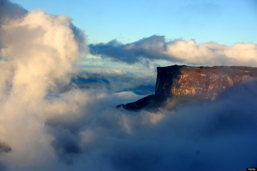
Mount Roraima is the highest of the Pakaraima mountain chain in South America and one of the world’s most extraordinary natural geological formations. The 31 square kilometer summit area of Mount Roraima is defined by 400 meter tall cliffs on all sides and includes the borders of Brazil, Venezuela, and Guyana.
If you think you’ve seen beauty and want to still do some exploring, then this must be on your list. It is also known as Tepuy Roraima and Cerro Roraima. First described by the English explorer Sir Walter Raleigh in 1596, its 31 kilometers summit area is defended on all sides by tall cliffs rising to 1,300 feet. The mountain also serves as the triple border point of Venezuela, Brazil and Guyana as noted above.
To get there, you need to head south in Venezuela – Mount Roraima lies on the Guiana Shield in the southeastern corner of Venezuela’s 30,000 square kilometers Canaima National Park forming the highest peak of Guyana’s Highland Range. The tabletop mountains of the park are considered some of the oldest geological formations on Earth, dating back to some two billion years ago in the Precambrian.
The highest point in Guyana and the highest point of the Brazilian state of Roraima lie on the plateau, but Venezuela and Brazil have higher mountains elsewhere. The tabletop mountains of the Pakaraima’s are considered some of the oldest geological formations on Earth, dating back to over two billion years ago. The result? An eerie, life changing and unforgettable experience!
Photo credits: Getty and All that is interesting.

Renee Blodgett is the founder of We Blog the World. The site combines the magic of an online culture and travel magazine with a global blog network and has contributors from every continent in the world. Having lived in 10 countries and explored over 90, she is an avid traveler, and a lover, observer and participant in cultural diversity. She is also the founder of the Magdalene Collection, a jewelry line dedicated to women’s unsung voices and stories, and the award-winning author of the bestselling book Magdalene’s Journey
She is founder of Blue Soul Media and co-founder of Blue Soul Earth as well as the producer and host of the award-winning Blue Soul CHATS podcast, that bridges science, technology and spirituality. Renee also founded Magic Sauce Media, a new media services consultancy focused on viral marketing, social media, branding, events and PR. For over 20 years, she has helped companies from 12 countries get traction in the market. Known for her global and organic approach to product and corporate launches, Renee practices what she pitches and as an active user of social media, she helps clients navigate digital waters from around the world. Renee has been blogging for over 16 years and regularly writes on her personal blog Down the Avenue, Huffington Post, BlogHer, We Blog the World and other sites. She was ranked #12 Social Media Influencer by Forbes Magazine and is listed as a new media influencer and game changer on various sites and books on the new media revolution. In 2013, she was listed as the 6th most influential woman in social media by Forbes Magazine on a Top 20 List.
Her passion for art, storytelling and photography led to the launch of Magic Sauce Photography, which is a visual extension of her writing, the result of which has led to producing six photo books: Galapagos Islands, London, South Africa, Rome, Urbanization and Ecuador.
Renee is also the co-founder of Traveling Geeks, an initiative that brings entrepreneurs, thought leaders, bloggers, creators, curators and influencers to other countries to share and learn from peers, governments, corporations, and the general public in order to educate, share, evaluate, and promote innovative technologies.


