Photo credit: Brinela Miscovic
Over the years, I’ve had the chance to explore much of Canada, including and especially Southern Ontario. And each time I head out, I discover something new, unexpected. It leaves me amazed, often speechless. Whether it’s hiking in national and provincial parks, standing underneath gorgeous waterfalls or swimming in Caribbean-looking turquoise water, the places to see and the beauty all over this province is truly endless.
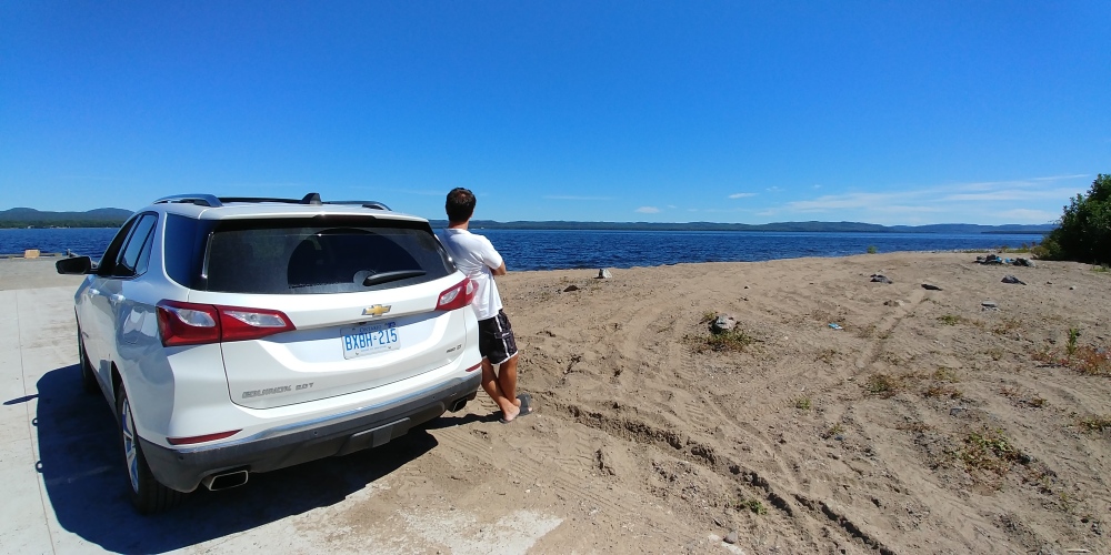
I am extremely grateful to General Motors of Canada and Chevrolet Canada for giving me a chance to go on a road trip of a lifetime. I was given the keys to a Chevy Equinox to drive from Thunder Bay, Ontario to Sault Ste. Marie, Ontario. Along Highway 17, part of the Trans-Canada Highway that cradles the Canadian Shield and hugs the glorious Lake Superior coast.
As soon as I got in the car, I connected with the super fast onboard 4G WiFi, opened up the sunroof and gave my vehicle a name for the week (Enrique, the Equinox). One push button start later, I hit the ground running and before I knew it, I started to realize that not only was Ontario even more beautiful than I thought but with each passing experience, I appreciated and fell more in love with Canada than I ever thought I could.
Here are 15 fun experiences I had along Highway 17 that will make you want to get in the car and see this piece of Canadiana for yourself.
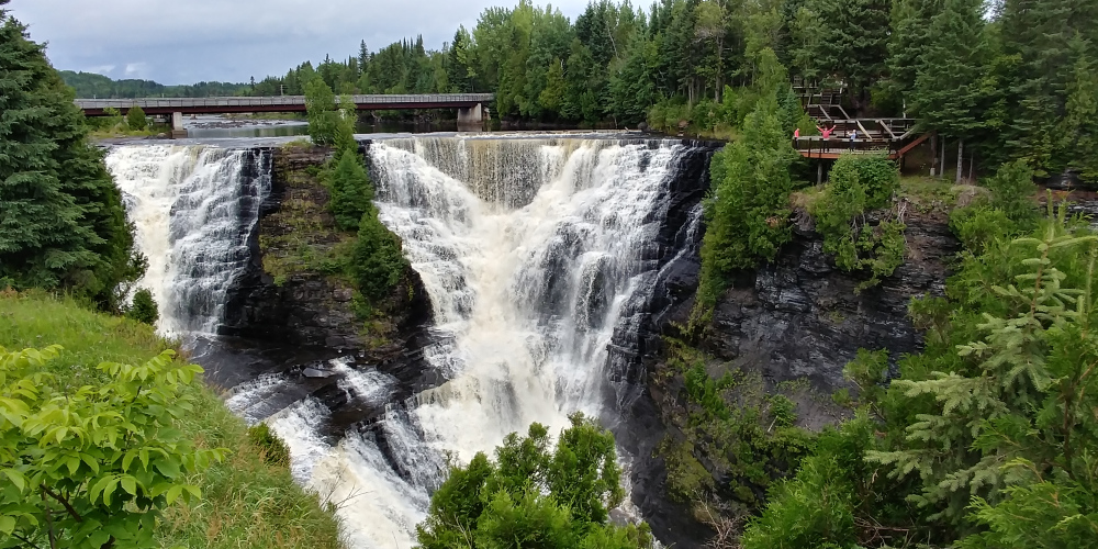
Kakabeka Falls Provincial Park
Drive about 30 minutes west of Thunder Bay and you’ll discover Kakabeka Falls. Nicknamed “the Niagara of the North”, these falls have a drop of 140 feet with water falling into a gorge carved out of Precambrian Shield. The rock face itself is made of unstable shale while the rocks are home to some of the oldest fossils in existence (some 1.6 billion years old).

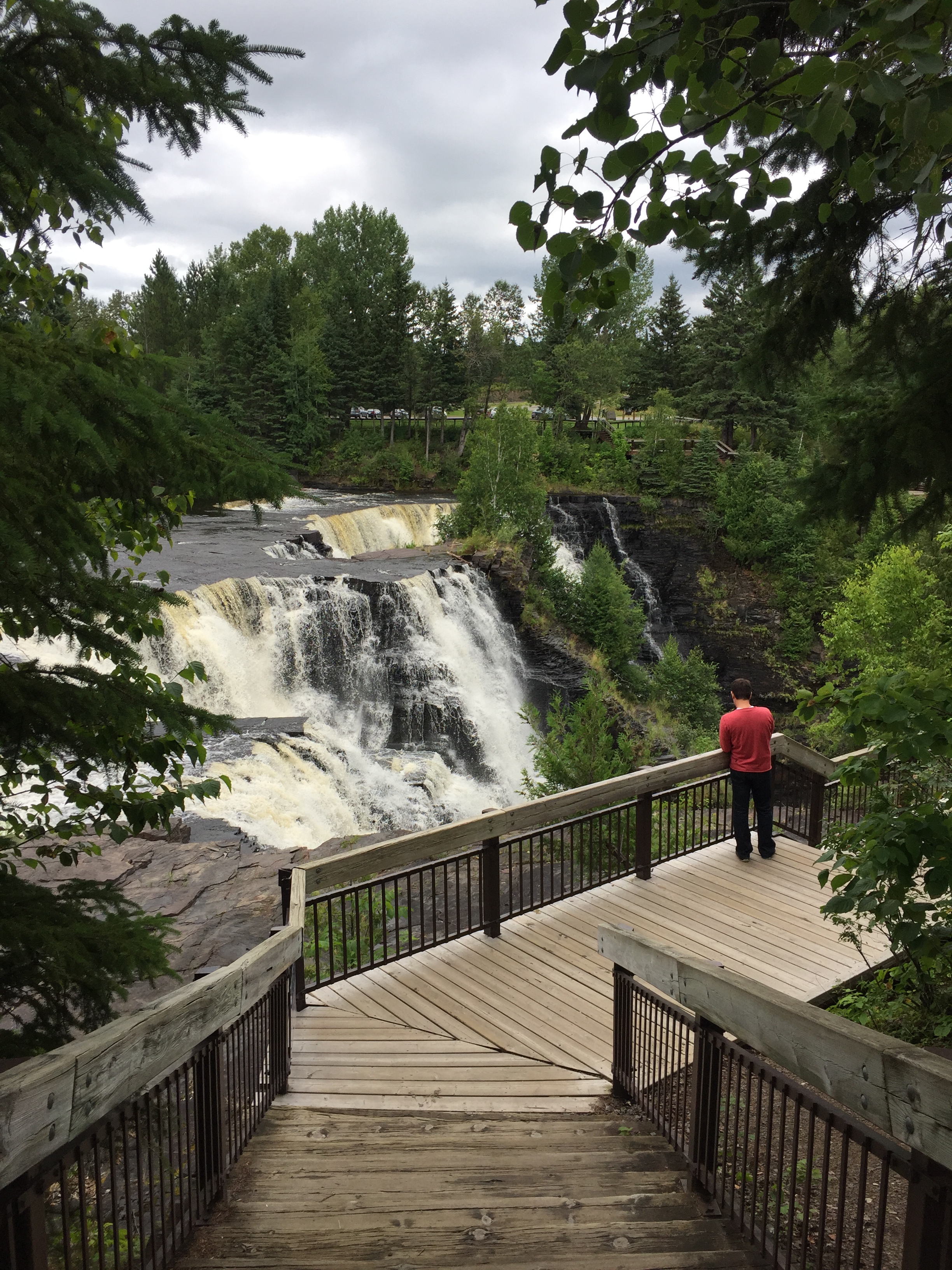
The falls are a short walk from the parking lot with many lookout points. If you want to camp, there are nearly 170 camp sites, 90 of which have electricity. If you want to hike, the park has nearly 18 kilometres worth of hiking on six trails. For more info about fees and location, check this link.
Mount McKay
Located just west of Thunder Bay, on the Native Reserve of Fort William First Nation, Mount McKay is tough to miss. After all, it not only stands very tall at 1,500 feet above sea level but it’s also the highest and most northern of the Nor’Wester Mountains. Originally known as “Thunder Mountain”, it’s used by the Ojibwe for sacred ceremonies.

The vantage point is spectacular, giving you a great view of the surrounding area, including Sleeping Giant Provincial Park across the bay.
Sleeping Giant Provincial Park + Sail Superior
Speaking of Sleeping Giant, this is a serious must experience. Fact is, a trip to Thunder Bay isn’t complete until visiting and/or hiking it. The Giant is located on the other side of the bay and is no doubt considered to be the icon and mascot of the city.
I’ll be honest, looking at the park from afar, it looks and feels intimidating. It actually does look like a sleeping giant that will move at any minute and stand up. Looking at the park from Thunder Bay’s waterfront, you get an idea of what I’m talking about.

It doesn’t look too far away but it does take about an hour to get to the park. There, you’ll find 80km of hiking trails, over 200 bird species, boreal forest, even wolves and moose. Full service cabins are available too. If you’re capable, wiling and have enough stamina to hike The Giant, then you must give it a shot. From the parking lot, expect to walk between 4-6 kilometres before you even get to the Giant inclines. From there, depending on the trail you choose, age and fitness level, it will take you anywhere between 2-4 hours to climb up and back down. Each trail going up is anywhere between 1-4 kilometres straight up the mountain.
Bring plenty of water and snacks to keep your energy up, wear the right footgear and leave yourself plenty of time (4-6 hours) because it’s not easy. You can hike The Chest, Top of The Giant, The Knees as well as The Head. Yes, it’s very challenging but the rewards far outdo the pain. Because when you get to the top, you realize that it was all worth it.
If you prefer to save time and just do the hike up the mountain, then you can always sail to the base. Sail Superior offers a variety of experiences including a wine and cheese cruise, harbour cruise and a hike ’n sail cruise. Greg and his team sail on the largest freshwater lake in the world and take you to the base of the The Head trail. It’s only up from there.

Of course, if you want nothing to do with hiking or sailing, you can always hit the Thunder Bay Lookout. Located within Sleeping Giant, look for the sign off the main road into the park (Highway 587). Turn and drive for about 9 kilometres on a gravel road until you hit the parking lot. This isn’t for the faint of heart but if you can handle standing on a platform that extends several feet out from the cliffs, overlooking Lake Superior, then good on ya.


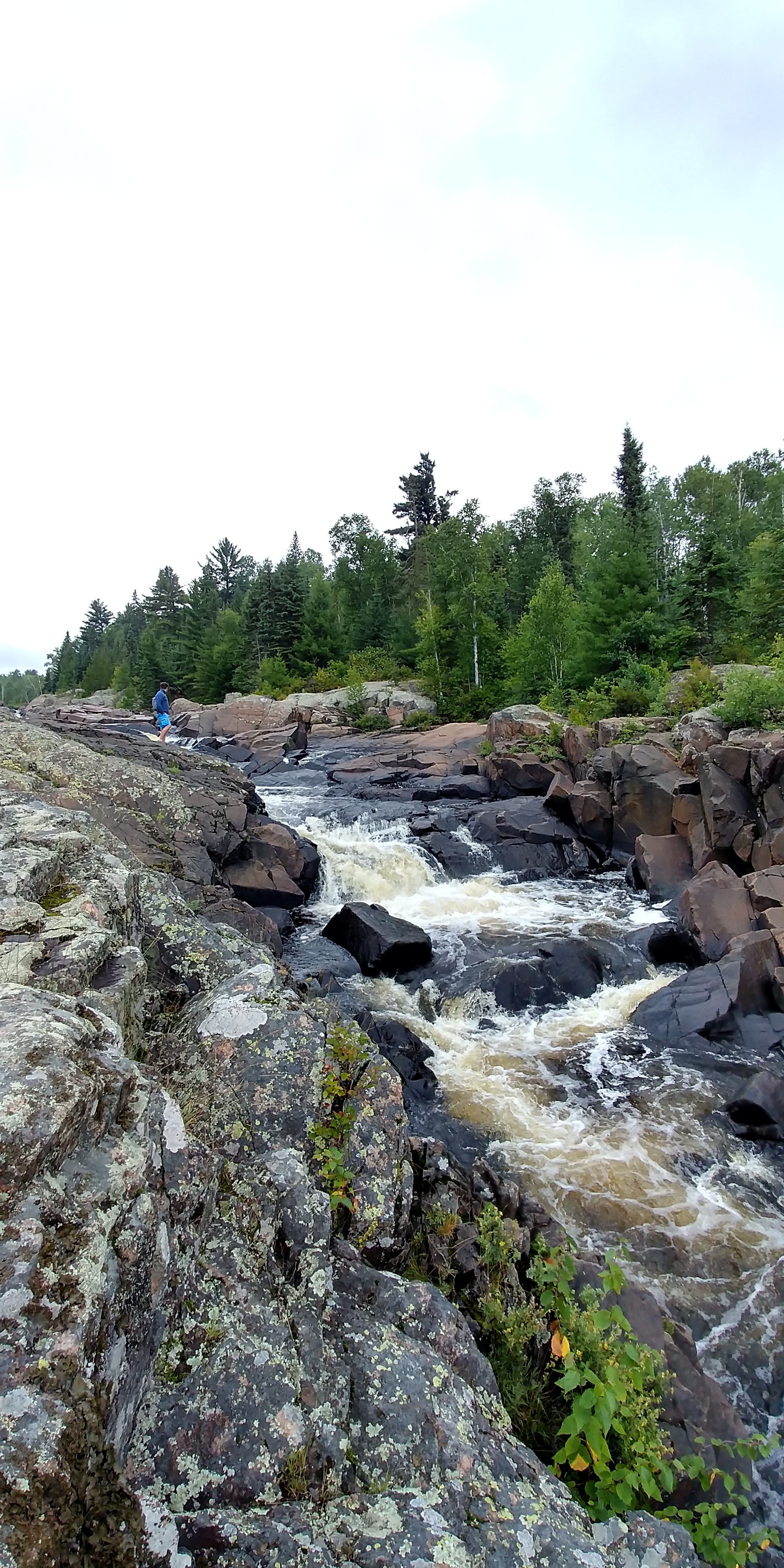
Cascades Conservation Area
Drive about 20 minutes northeast of Thunder Bay and you’ll find one of the most beautiful, accessible natural wonders in the area. What’s not to love about cascading rapids? Although the terrain can be a bit hilly and sometimes uneven, the trails going through the poplar and birch forest are close to the parking lot and for the most part are easy, paved and accessible for everyone. Inhale the fresh air, take a walk towards the water, have a BBQ or even a picnic on the rocks.
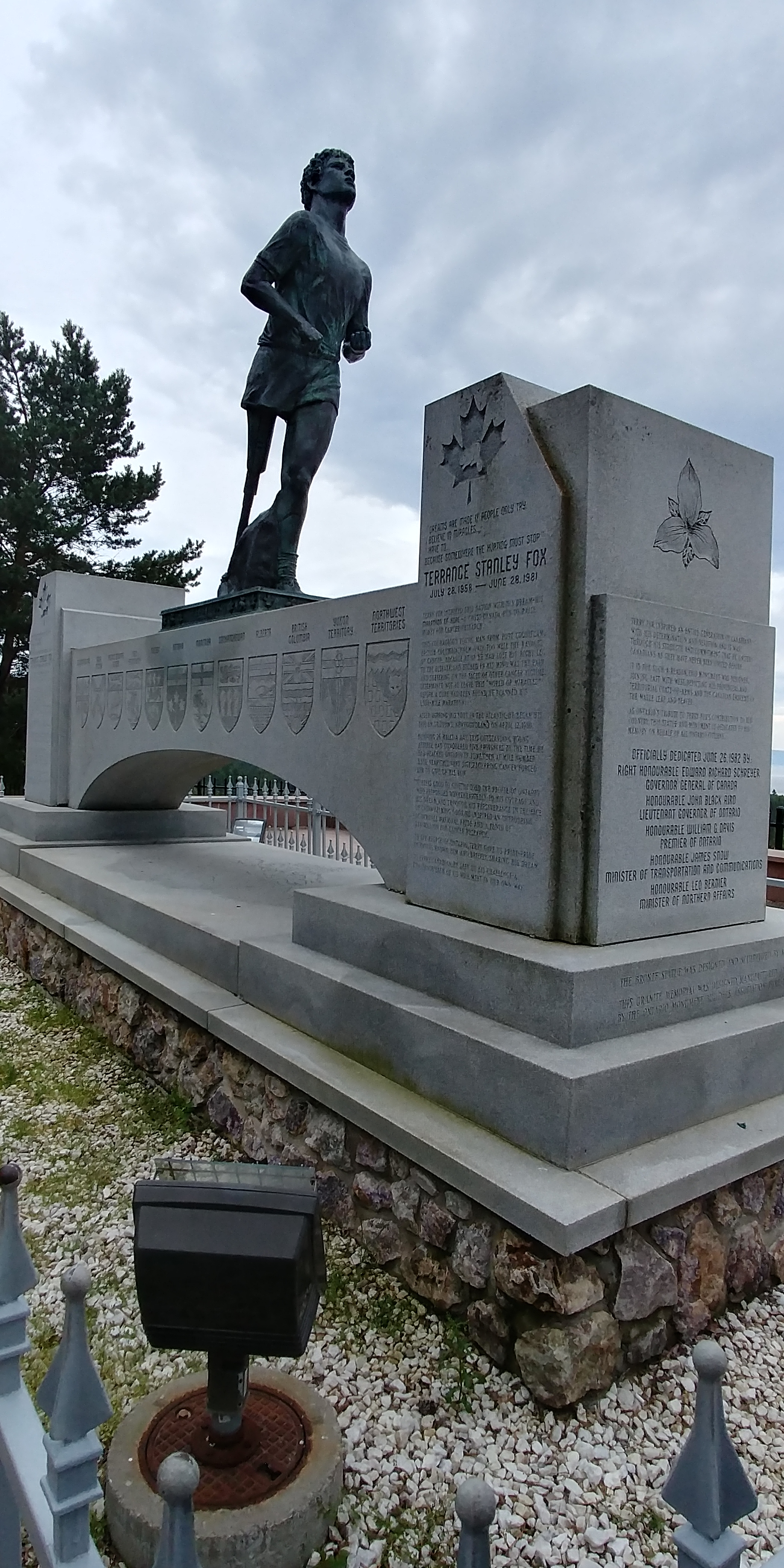
Terry Fox Memorial
Stopping here is an absolute must for any and every Canadian. Diagnosed with bone cancer at 18 and forced to have his right leg amputated, Terry Fox decided to help other cancer patients by raising money and awareness by running across Canada.
His ‘Marathon of Hope’ started in St. John’s, Newfoundland in 1980. He ran nearly a marathon per day, crossing Canada’s Atlantic provinces, Quebec and Ontario before being forced to stop just east of Thunder Bay. In total, Terry ran 5,373 kilometres in 14 months. He passed away at the age of 22 in June 1981.

A cultural icon, the Terry Fox Run takes place every September in communities across Canada and even worldwide. To date, over $650 million has been raised worldwide for cancer research in Terry’s name. He is the epitome of courage, perseverance and strength.
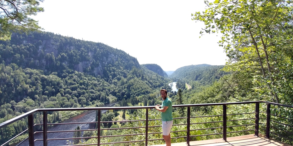
Ouimet Canyon Provincial Park
Further east along Highway 17, you find Ouimet Canyon. I saw pictures of this place before I got here but nothing prepared me for what I actually saw in person. There are few words to describe the beauty of this place. Actually, the first thing that came to mind was, ‘where am I, exactly’?
A trail and boardwalk connect you to two lookout platforms. There, you’ll find sheer cliffs, a gorge that’s more than 300 feet deep, almost 500 wide and two kilometres long. Arctic plants, normally found about 1,000 kilometres north, somehow survive here at the bottom of the canyon.

Road Trip = Roadside Attractions
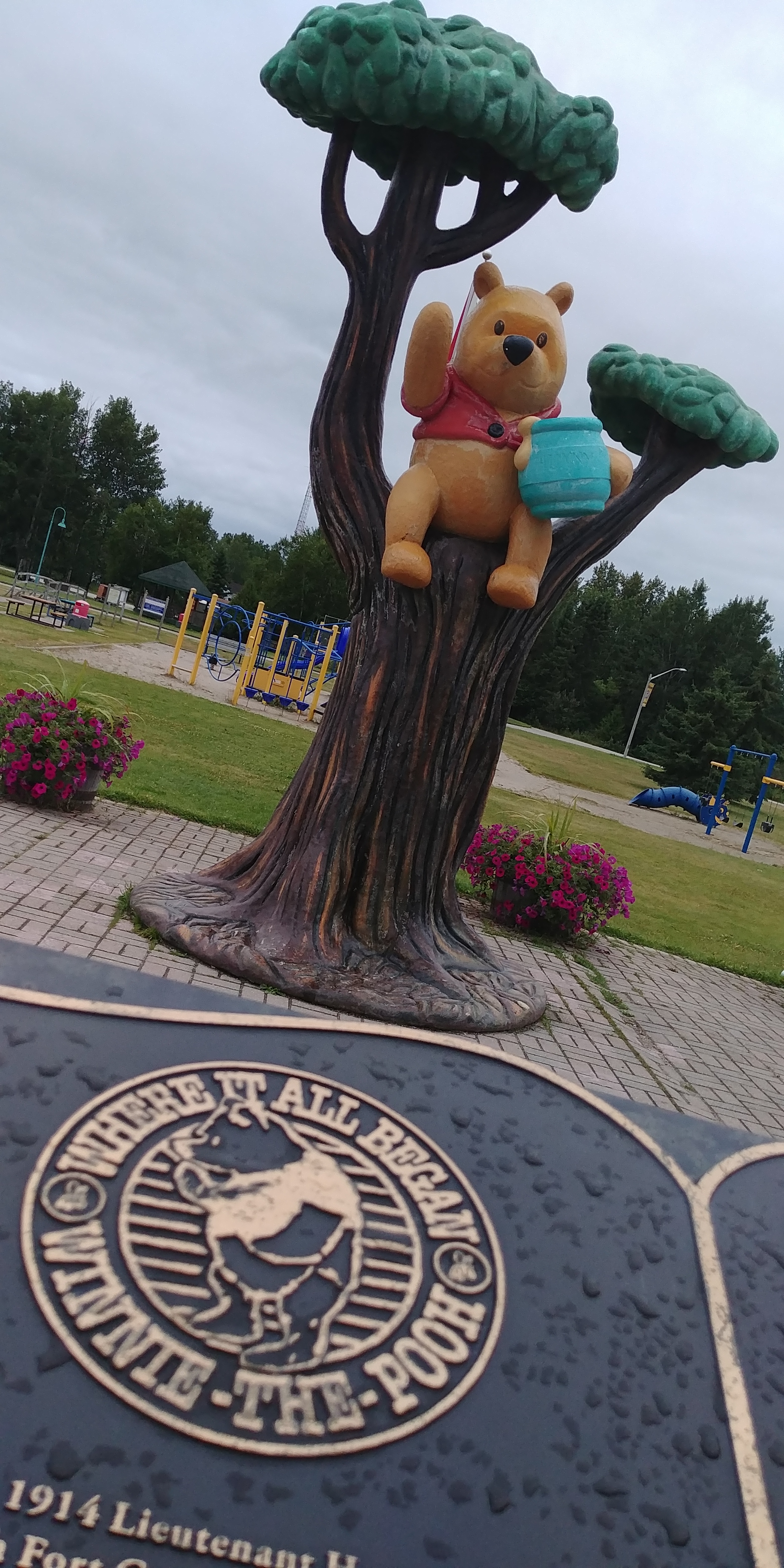
Winnie the Pooh
Expect to find a few along 17, including the Winnie the Pooh statue in White River, Ontario. It’s a good place to stop, stretch your legs and learn a bit about Canadiana. In fact, White River has held a Winnie the Pooh festival every August since the late-80s.
Wawa Goose
I’m a sucker for over the top Canada geese. Easily one of the most photographed landmarks in the country, the idea of building the goose was actually quite ingenious. In 1960, the last link of the Trans-Canada was finally installed, connecting Sault Ste. Marie to Wawa and Western Canada. However, the highway totally bypassed downtown Wawa altogether.
Upset locals, especially Al Turcott decided to do something about that – build something that would force travellers to get off the highway, stop, look around and explore the town. The Canada Goose was born and since then has become Wawa’s iconic symbol. So as they say in Wawa, stop and take a gander.

Further along 17, just east of Sault Ste Marie in Echo Bay, Ontario, you’ll find the largest loonie in the world. Even further east along 17, in Sudbury, Ontario, you find the Big Nickel, a 30 foot replica of the 1951 Canadian nickel built in 1964.


Pukaskwa National Park
Talk about a park complete with hikes that can last up to one week! Pukaskwa has everything from backcountry camping and paddling to canoeing and kayaking.
If you have a day, want to get outside and take in some fresh air and awesome scenery, consider doing the White River Suspension Bridge Trail. This 18 km day hike through forest, wetlands and Canadian Shield will reward you with a beautiful walk across the White River suspension bridge which stands about 23 metres above the Chigamiwinigum Falls.

For this nine-hour hike, make sure you wear the right footgear, pack plenty of liquids and snacks and of course, bring the bug protection.
Lake Superior Provincial Park
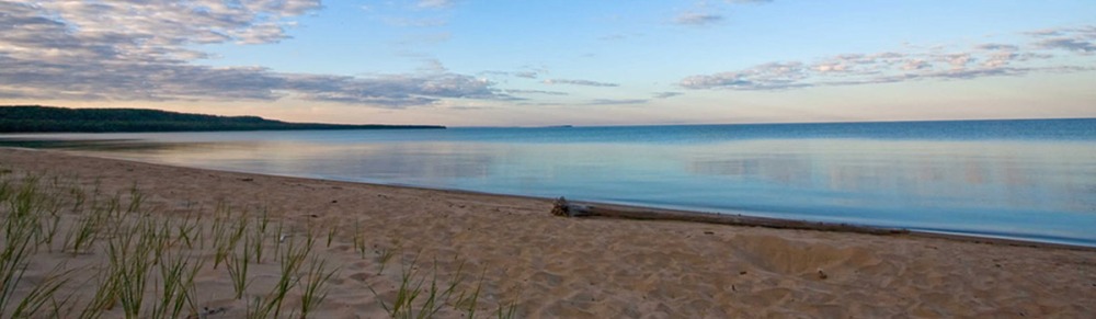
Old Woman Bay
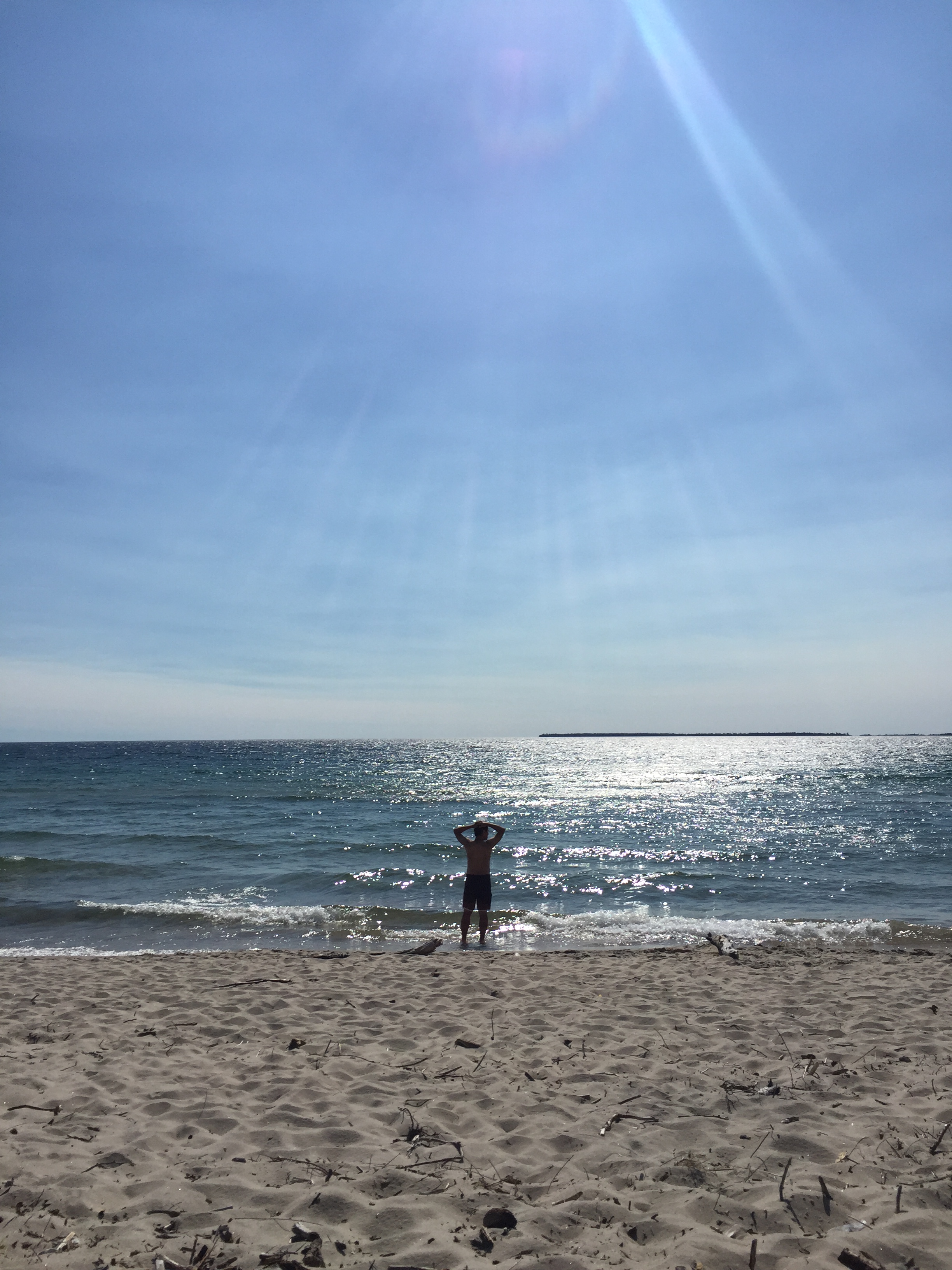
Between Wawa and Sault Ste. Marie, the scenery gets ridiculously beautiful. With pristine blue coastline on one side and mountains on the other, I had to remind myself that I was still in Ontario. Dumbfounded and in total awe, it felt more like I was driving down the California coast than the Superior coast.
On this stretch of 17, you go straight through Lake Superior Provincial Park which is loaded with incredible must-experiences along the way, including Old Woman Bay. A stunning stop that features cliffs and a sandy beach, it’s more than a place to just stretch your legs. Lay down a towel, stay a while.

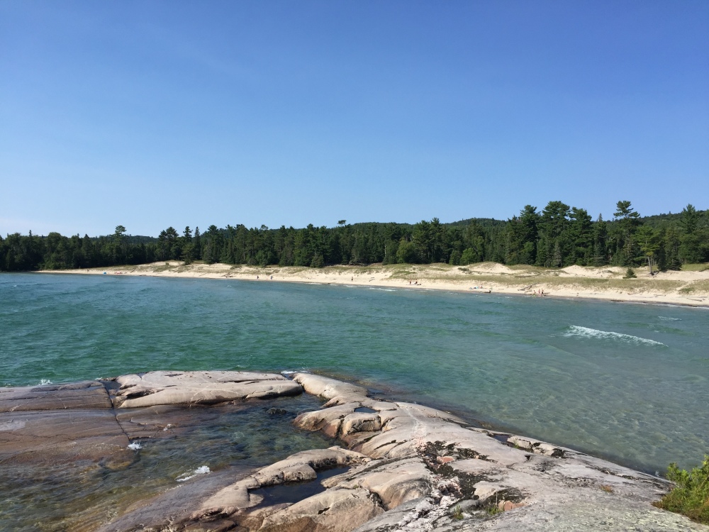
Katherine Cove + Bathtub Island
Located further south within the park, Katherine Cove features a gorgeous beach complete with sand dunes and crystal clear, turquoise water.
Meanwhile, steps away is Bathtub Island, a small, hidden gem that can only be found by a small trail opening in the forest along 17. You’ll figure out where it is as soon as you notice several parked cars along the side of the highway. If you decide to park, do it with care. After all, you’re parking a two-lane highway.
Pinguisibi Hiking Trail
Considered to be one of the more popular hikes in the park, the Pinguisibi or Sand River hiking trail runs for about six kilometres along a beautiful series of cascading waterfalls and river rapids that stretch as far as the eye can see. The Ojibwe, who have lived here for over 2000 years, call this river Pinguisibi for its fine white sand. The entire river is a designated canoe route.

Agawa Rock
Climb down 100 feet, through rock chasms, sheer cliffs and giant boulders. Then walk along a narrow stretch of rock, inches from the crashing waves coming from Superior. Balance yourself and experience the past in a way you never imagined.
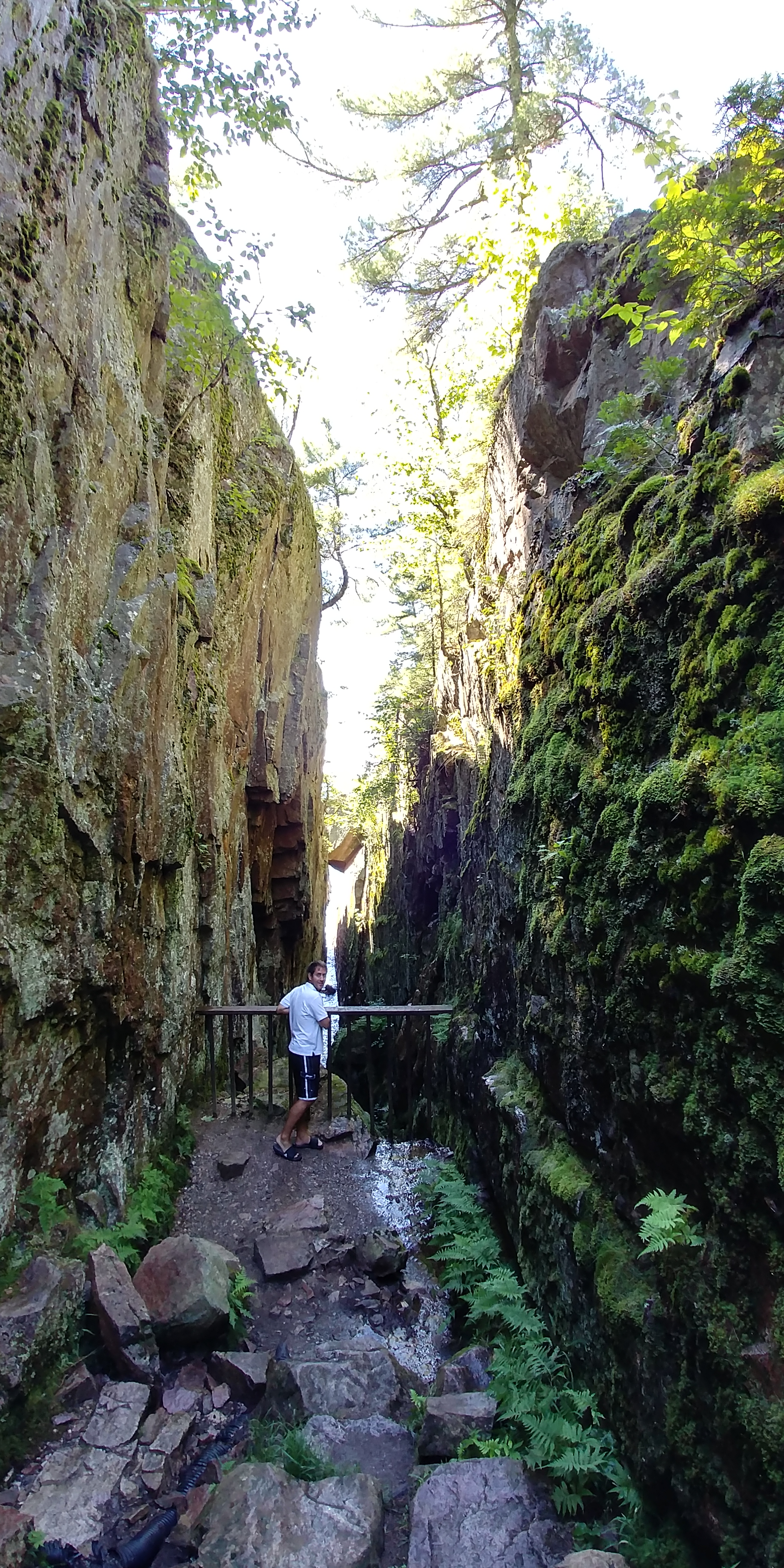
The Agawa Rock is a sacred site that features 35 ancient native red ochre images. The Ojibwe drew messages on the rock to record dreams, visions, animals and events. Images visible today include Misshepezhieu, the Great Lynx and spirit of the water. Only accessible when Lake Superior is calm (generally from May to September), you must always respect the site and be very cautious of the slippery rock ledge and unpredictability of the waves coming in.

**TIP – consider walking along the narrow passage barefoot for greater traction.
Chippewa Falls
Located about 40 minutes north of Sault Ste. Marie, the cascading 25 foot Chippewa Falls can be seen from the highway and viewed from several vantage points within the park. In the parking lot, you’ll notice a plaque indicating that you’re standing smack dab in the middle of the entire Trans-Canada Highway.


Pancake Bay and Batchawana Bay
With 300 campsites and a three kilometre beach with Caribbean-style blue waters, Pancake Bay provincial park is a must experience. Sand filled and shallow, it has some of the warmest water anywhere along Superior.
Nearby you’ll find another gem. Batchawana Bay is a day park only and offers more beach fun in the sun. To get a great view of the bay, consider going south on route 563. It’s off Highway 17 between Pancake Bay and Batchawana Bay provincial parks. On a clear day, the views are beautiful.
Agawa Canyon Tour Train
I can’t thank the good people of Sault Ste. Marie Tourism enough for their incredible hospitality. I was given the chance to experience what is truly one of the most beautiful sights I’ve seen in Ontario. The Agawa Canyon Tour Train sets off in Sault. Ste. Marie and heads north, inland to the Agawa Canyon Wilderness Park (ACWP) about 180 kilometres away.
Along the route, you’ll see lakes, cliffs, waterfalls, dense forest, all part of the rugged Canadian Shield. The highlight along the way is the curved Montreal River trestle – at 130 feet high and over 1,500 feet long, it’s an amazing sight!

At Mile 114, the train pulls into the station. At that point, you have 90 minutes to explore ACWP which features a 250 foot high lookout trail, Talus Trail which leads you to North and South Beaver Falls and a River Trail which leads you to the equally gorgeous Bridal Veil Falls. It’s a must experience and one that puts a perfect ending to an incredible road trip along a picturesque, adventure filled stretch of Canada!
Did I miss something? A big attraction along the way?

Jim Bamboulis has held several posts over the past 12 years, including National Sportscaster, Food Host and Writer, Talk Show Host, Olympic Researcher and Travel Film-maker.
Born and raised in Toronto, Jim learned early on that the combination of travel and food meant ultimate living. Combining his insatiable creative spirit and desire to document his travels, Jim took his unshakable travel bug and set off to explore. Add the fact that Jim also grew up in a Greek household and he learned that not only does Mom always make the best meals, but as importantly learned the importance of understanding and appreciating the countless beautiful cultures and the integral role food plays in every corner of the World.
In August 2009, Jim founded Travel Mammal, a site that brings together his travels and experiences (both good and terrifying) with the hope that others are inspired to share their own. We are all storytellers, especially when it comes to travel and food. He urges everyone to be inspired, explore and love the world and the people that share it with us. Or in other words, Live to Travel and travel to live!