In fact I had butterflies when we started this morning (you can see me talk more about it in the video below). Would we be able to make it? Would we make it before losing our way in the twilight? How far were we actually going? (We weren’t exactly sure.) Where is the trail? We set off slightly blind, except that we could see our goal, Tajumulco, towering above us.
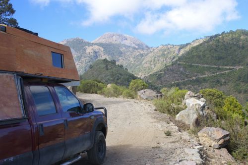
Passing through the town of San Marcos near the Guatemala/Mexico border, we asked a local man for directions to the mountain. We knew there was a road that would take us nearer the summit, thereby reducing our overall hiking time. Since we have five little ones, we thought that would be best.
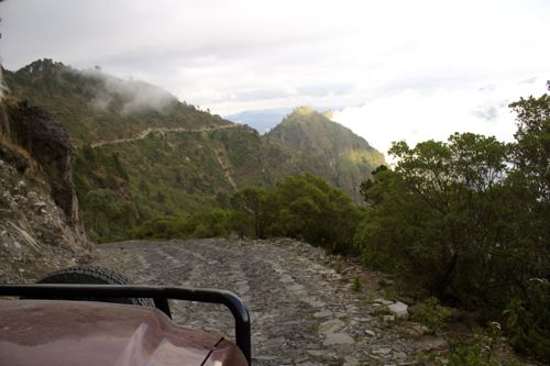
He showed us the turn off, and we followed the well made (although bumpy) cobblestone road through high mountain villages that reminded my hubby of his time in Peru.
The route was one lane without much space on either side, but we finally found a place to park our rig, near where the road began to wind back down into the valley below. From there, we weren’t quite sure where to go. Was there a trail from here? Where was it? (We’d tried to do our homework, but there was a lack of information. Mostly we just looked closely at Google Maps). We find a path and start following it. It’s not heading up, but around the foothills instead. It would eventually lead where we wanted to go, right?
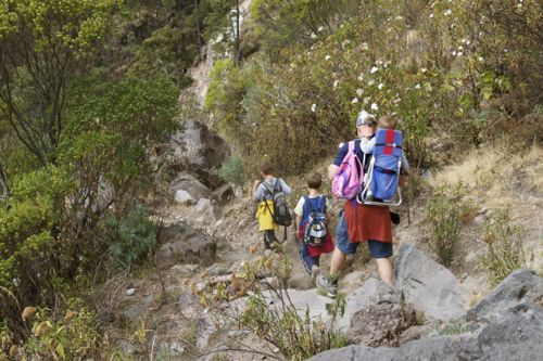
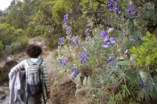
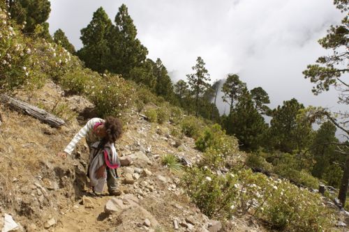
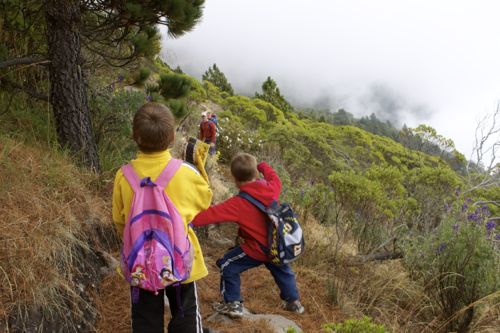
The trail is fairly easy, and the kids are doing well, except for Kyah who started feeling queasy almost as soon as we began (she blamed it on that chunk of coconut she ate when we were starting out.) She is plodding along slowly behind, with a bottle of peppermint essential oil to her nose.
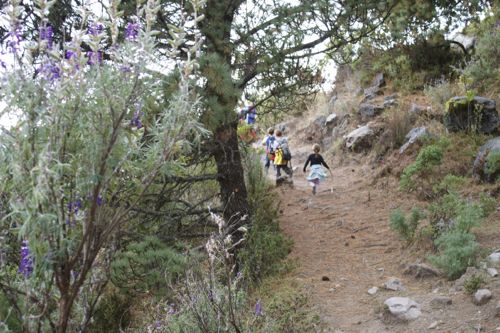
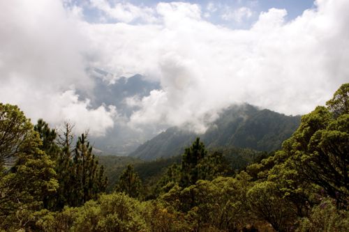
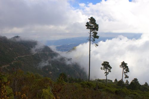
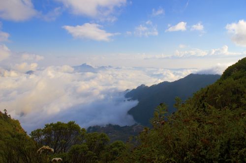
The alpine weather is fickle, switching intermittently from cloudy, breezy and cool (and requiring a jacket or two) to warm and summery and causing perspiration. The clouds paint lovely pictures on the mountains and the pale blue sky, and when they occasionally clear, we catch a glimpse of the mountain valley far below.
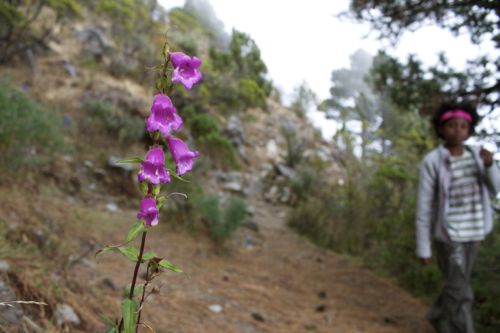
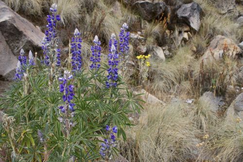
After an hour or so it’s time for a lunch (and potty) break. Greg expresses doubts about being on the right trail, and if we’re heading in the right direction. There had been a possible turn off back there. Should we have taken it? Already having traveled this far, we’d lose time back tracking. We decide to continue on and just see where this trail leads. If we haven’t reached the peak by 2:00 pm, we’ll turn back, to make sure we’re off before dark. I’m feeling fairly good, but I pace myself (and take pictures of the flowers), and stay behind with Kyah, who isn’t feeling any better.
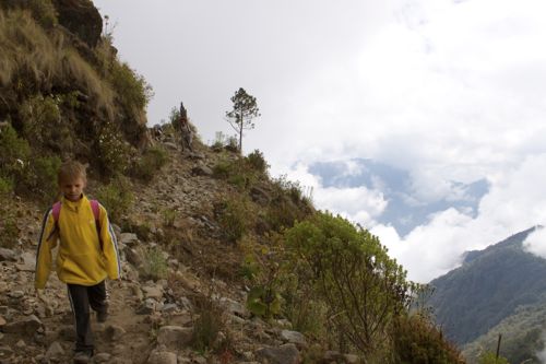
The air is getting thinner. Greg estimates we’re at least 3650 m (12,000 ft). Our aim is the ridge we can see above us. From there we’ll gain some perspective, and see if we’re even on the right mountain.
And so we come back to where we began. Right foot. Left. Deep breath. Make it to that stump. Just a little bit further. Kyah’s legs are shaking, her breath shallow.
Parker reaches the ridge first.
“It’s the top!” he exclaims.
“Can you see the volcano?” Greg asks.
“No.”
Disappointment. Maybe this is the wrong mountain, and we’re not even close.
It’s confirmed when Kyah and I finally reach the others. This is only the top of a ridge, a saddle back between two peaks, which are shrouded in clouds.
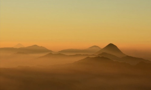
I’d had visions of a spectacular view from the top of Central America. Now, it’s 1:30 pm, and we can’t even see the top (nor do we know how close it is). For the safety of our family, we’ll have to head back down, disappointed.
I had visions of something like this (photo courtesy of Guat360.com)
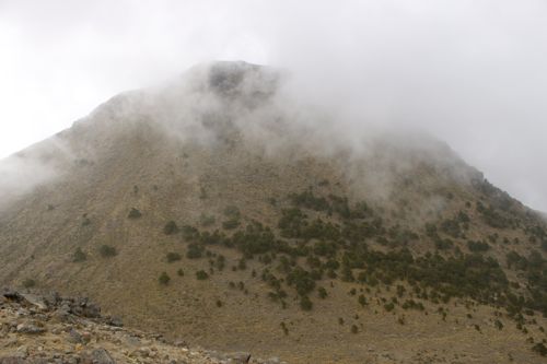
Greg and the boys decide to ‘see what they can see’ by climbing to the top of the cloud covered peak above us. (He takes my camera in case he gets a glimpse of the top.) The girls, Atlas and I rest. I lay down on tufts of alpine grass, lightheaded, and now feeling sick to my stomach. Kyah sits quietly. The clouds grow thick, and I begin to shiver. Aaliyah huddles close, and asks if we can go back now. I’m definitely ready.
“As soon as daddy comes back,” I tell her.
He comes back, but he’s alone. He looks a little worried.
“Where’s the boys?” I ask.
“I left them up there. I don’t think it’s the top, but it is a summit. There’s campfire rings and litter, and there’s a trail off the back side (the side we’re actually parked on.) I think it’s our best bet for actually getting off this mountain. If we go this way (pointing to the descent before us), we could run into a cliff and have to turn back. And we can’t go back the way we came, it will take too long.”
We must go up before we go down. Greg carries Atlas and everything he can (the boys left their packs with us.) He helps Aaliyah while I clamber slowly with Kyah.
We don’t make it very far before Kyah is vomiting. Her body heaves violently, and when she’s done she can’t stand up without help, she’s so weak.
“You’re so tough, Kyah,” I tell her. “We can do this, just one step at a time.”
I speak out loud and help and encourage her with every step. We reach the final upward climb, which requires bouldering to get on top of the large stone which stands in our way. Using both hands, I pull myself up. Will she be able to do this in her weakened condition, without falling down the rocky ridge behind her?
Giving her my hand, I help pull her up. This is it! No more climbing! It should be downhill from here.
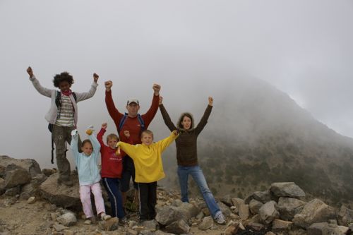
Parker’s butt is exposed to the frigid wind when we rejoin the boys, waiting for me to bring toilet paper (oh wait, I wasn’t supposed to tell that part.) I recollect my camera and snap a triumph shot.
When the clouds part, we catch a peek of her behind us — Tajumulco. So close and yet so far!
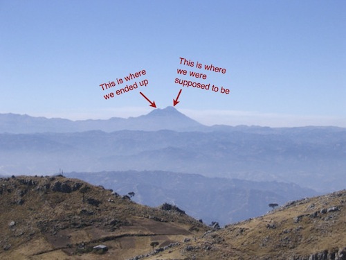
Photo courtesy of SummitPost.org
We’re close enough that I’m tempted to go for it… but it would easily take another hour, and then we for sure would not make it off this mountain before dark. So we content ourselves with climbing to the second highest point in Central America. At least for today.
Down, down, down without an end in sight, sliding on inches thick of pine needles. In a moment of ‘tender mercy’, the clouds part, and I catch a glimpse of the road far below. The sound of Latin music drifts up from the aldea (town) nestled in the foothills — the same aldea that is directly below where we parked. We are headed in the right direction!
As the sun sinks lower and the temperature drops, we make it back to ‘Big Red’. We congratulate each other on a job well done, and reminisce on our last big outdoor family triumph, hiking five miles in Capitol Reef National Park. (That time we did get caught in the dark.)
Clambering in, we crank up the heat and begin our drive down the mountain, enjoying the view from the top of Central America.
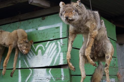
Oh yeah, and the dead coyotes hanging at the local tienda. There’s always something unexpected in Guatemala.

Rachel Denning is an unassuming mother of five who never really did any international traveling until she had four children. After a second honeymoon to Playa del Carmen, Mexico, she and her husband decided to sell most of their belongings and move their family abroad.
Driving from the United States to Panama, they settled in Costa Rica for a year, until the U.S. financial market crash in 2008, when they lost their location independent income. Returning to the United States to look for work, they knew they’d be back ‘out’ again, having been officially bitten by the travel bug!
Despite adjustments to living a simpler life (or perhaps because of it), they were able to save enough money to move to the Dominican Republic in 2009. After six months they came back to the States once more, where they were offered employment working with a non-profit organization in India.
They spent five months living in Tamil Nadu, then returned to the States once more (to Alaska) so they could have baby number five – Atlas.
From there, they set out in April of 2011 to drive, in a veggie powered truck, from Alaska to Argentina, visiting every continental country in North and South America.
Travel is a part of their life now, and they can’t imagine doing anything else. Rachel photographs and writes about their incredible family travel adventures on their website, and they also have resources that encourage others to live a deliberate life.