All the positive things you’ve heard about New Zealand… are true. The scenery, clean air, wide open spaces and people are gorgeous, breathtaking, welcoming and cordial (in that order). And indigenous Māori culture is everywhere.
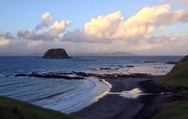
After driving 3,550 kilometers (2,205 miles) around the north island – from verdant coastlines to volcanic craters, my overall impression was of a dynamic land shimmering with vibrant contrasts; from piwakawakas to penguins, forest falls to fjords, hobbits to hipsters. I recommend you consider going there some day, and if you’d like some details – keep on reading!
San Francisco to Auckland flight time is approximately 12 hours, generally with a headwind, so the return is shorter. My month-long visit was in their late spring (mid-November to mid-December) which affords the luxury of reasonable weather and essentially no crowds. Only in Auckland did I see locals on the beach and in the water since the summer switch over was still underway.
Being a hiker, I was in heaven exploring dense rainforest trails, traversing spectacular vistas and ascending sleeping volcanoes while staying at well maintained campsites with few if any other people. New Zealand’s Department of Conservation (“DOC”) is an excellent resource for wilderness wanderers, providing campsites with clean communal toilets and running water for $10NZ per night.
For a more developed camping experience I recommend staying at a “Top 10” holiday park – but be prepared to rub shoulders with families and empty nesters piloting moderate to honkin’ big recreational vehicles. These places also let in campervans in. The benefits of a holiday park include individual electrical hookups, shared full kitchen/bathroom facilities, a swimming pool and bubbly hot tub. Beware the smaller parks which can be “homey” in a back-in-time 1960’s class all their own. Funky fun if a lack of modern amenities suits your taste.
Now a bit of pre-holiday park history…
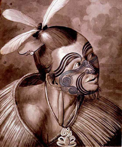
New Zealand’s island pair, like most south Pacific outposts, are a colorful blend of contrasts. The term ‘Polynesian’ certainly applies to this region east of Australia, with today’s Māori inhabitants cohabitating alongside mid-18th century northern European descendants.
Based on radiocarbon dating and DNA analysis it appears the first Māori tribes were of Moriori ancestry, landing on New Zealand shores around 800 AD. Anthropologists widely accept these early people sailed in long canoes from the Southern Cook (i.e. Rarotonga) and Society Islands (Tahiti, Bora Bora), a journey spanning roughly 3,000 miles.
Perhaps most intriguing is the reality these tropical settlers navigated the open ocean by observing and paying close conscious attention to the world around them. They applied a deep understanding of sun/star paths, water currents, and bird behavior, together with an intimate cosmic connection our modern culture has replaced almost exclusively with computer-enhanced thinking machines. (Seems there were intuitive technologies prior to GPS smartphones!)
Shining along New Zealand’s western shores is the Tasman Sea, named in 1642 by Dutch explorer Abel Janszoon Tasman (great middle name) with financing by the Dutch East India Company’s pursuit of treasures in remote, unknown regions. This first voyage failed to produce any profitable precious metal relics or grabbable resources so additional Company visits were abandoned.
It was Britain’s scientifically-oriented Captain James Cook who, 127 years later, sighted New Zealand and mapped it quite differently than Tasman’s attempted career-saving description of a “vast southern continent.” Cook’s voyages in the vicinity of New Zealand’s north and south islands became the calling card of the British-heavy presence so notable today.
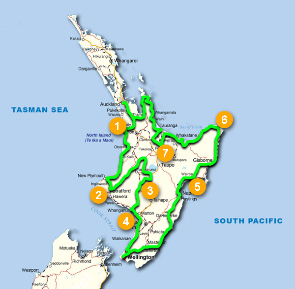
So here we go across and around today’s north island. The map shows my driving route; heading out of Auckland and moving counterclockwise for an Auckland return several weeks later. The numbers show where the things I’ll describe below are located.
The primary urban centers consist of the most populated Auckland (above map: #1), and hip, windy, smaller capital of Wellington (above map: below #4). I was impressed with the modern atmosphere in both cities, but if you are in your 20’s or 30’s, bypass Auckland and head south to Wellington where there is a palpable vibration of creative energy flowing through the streets.

Auckland’s 328 meter (1,076 ft.) Sky Tower – the tallest free standing structure in the Southern Hemisphere
Curious Auckland facts:
- Settled by Māori people in 1350 AD with a population of 20,000
- Today has the largest Polynesian population of any city in the world
- Has land, a sea, and an ocean surrounding it
Curious Wellington facts: (other than the one on Wellington’s wharf, above)
- Harbors a fantastic design, arts, restaurant, café and nightlife scene
- Windier in November than Chicago is all winter (not kidding)
- Home of WETA Digital, life-givers to Lord of the Rings stories
Since I was focused on getting out of the urban frenzy, my time was spent mostly on the road and in nature.
Highlights included:
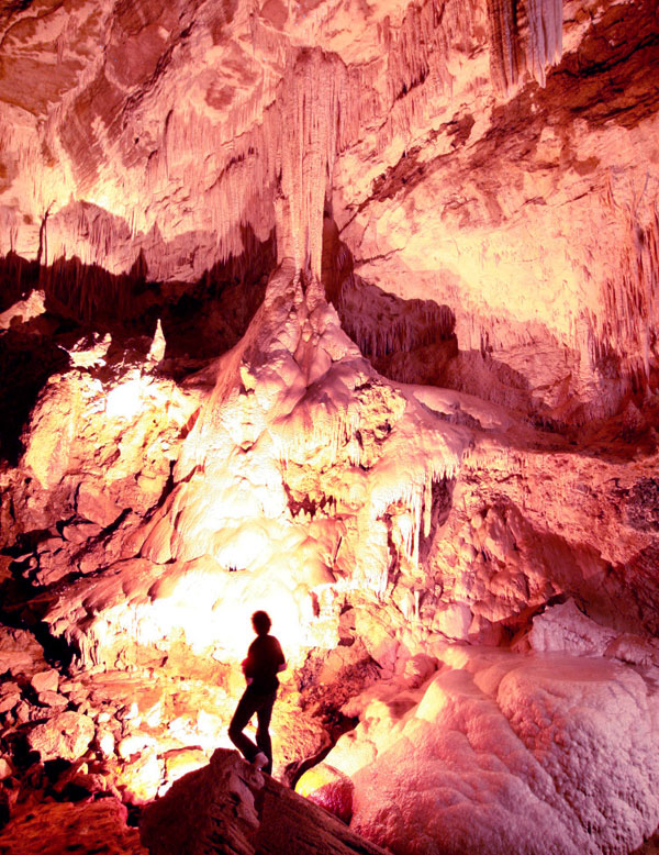
1) NIKAU CAVES; where proprietors Phillip and Anne Woodward warmly welcome guests to wondrous subterranean chambers, clear pools and very cool glow worms – minus the crowded throngs of nearby big-biz cave tours. Here, Philip dons his sensible wet rock shoes & helmet, hands out torches (flashlights) and takes a group of 10 max. deep into the Earth. Be sure to have a home-cooked meal and even stay the night with them. They have a beautiful dining facility surrounded by spacious outdoor decks and lawns with emerald green sheep grazing fields all around. Quiet, friendly, refreshingly unique, and only 90 minutes southwest of Auckland.
2) MT. TARANAKI
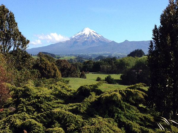
Volcanoes are a Kiwi hiker’s best friend, and for sheer magnetic attractiveness, Mount Taranaki (aka Mt. Egmont) is the premier north island peak to ascend. Having formed a prominent west-jutting peninsula 135,000 years ago, this 2,518-metre-high (8,261 ft.) stratovolcano rises skyward with a near perfect conical shape. On first seeing it on the horizon I became mesmerized – knowing I’d have to climb it! If you plan to go all the way to the top, head for the North Egmont visitor center to grab a map detailing the quite challenging Summit Track. It’s stunning up there.
3) TONGARIRO ALPINE CROSSING
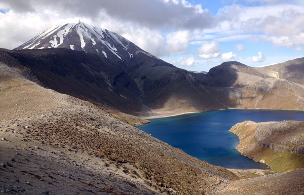
If you enjoy diverse volcanic terrain and a lot of walking then head to Tongariro National Park, near the southern center of the island. There you’ll hear a buzz about the 19.4-kilometer (one way) “alpine crossing”, which for years has attracted ‘trampers’ (track = trail + campers) and volcano aficionados the world over. As of this writing the second half of the crossing is closed due to sporadic ash-rock eruptions of the Upper Te Maari Crater on Tongariro’s north flank. I hiked several other trails in the park and was duly impressed – without the worry of pesky airborne boulders landing on my head.
4) KIWI CAN-DO AWARD
Imagine your driving glasses snapping in half at 3 PM on a Friday afternoon in an unknown town you’ve been in for less than an hour. Where do you go for a custom repair by 5 PM? If this scenario happens to you and you happen to be in quaint Wanganui, the answer is to head to J. Williams & Company jewelers. With my separate left/right eye spectacle halves sadly laid on his counter, managing director Philip Sell worked a miracle at their micro-tooled workbench with a tiny piece of metal rod drilled and epoxied to reconnect the halves. By 5:15 and without charge I was on the road; amazed, grandly grateful and thoroughly impressed by Philip & Team’s gold star Kiwi hospitality. A warm and very human interaction which I will long remember.
5) MORERE HOT SPRINGS
Nestled within a Department of Conservation reserve, this beautiful combination of adult and child-friendly environs beckons – a short 45-minute drive south of Gisborne on highway 2. For kids there are large open grassy areas to run and play. For families; picnic tables, an all-ages swimming pool, and a simple snack bar stocked with yummy stuff. For adults, a secluded couple of warm + hot mineral spa pools open to the forest are quiet and picturesque. Reasonable entry fees, clean facilities and, once again, warmly accommodating Kiwi spirit.
6) MĀORI COUNTRY
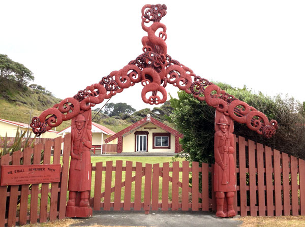
Mid-island on a major east coast peninsula is home to many Māori people; a raw land full of thick forests and pristine coastline – without resorts, tourists or shops diverting attention. This is the way New Zealand once was – before the plethora of non-indigenous sheep and cattle ranches. Between the towns of Gisborne and Whakatane is nary a petrol station nor restaurant. (I nearly ran out of petrol passing through this region) What I did experience every so often was a community area known as a marae; with meeting and social gathering buildings around a central courtyard and a welcoming hand-carved archway depicting mortal + spirit events. If you want to encounter a non-westernized part of New Zealand, respectfully explore this region, and ask before taking photos of sacred artifacts.
7) TOURISTY (untouristy) ROTORUA
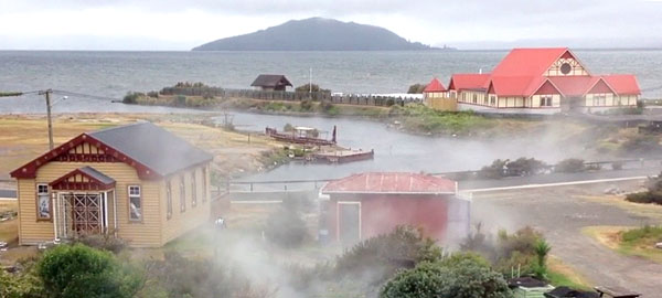
If your idea of getting out into nature finishes in a relaxing plant-bordered mineral pool, then a soothing massage, followed by a scrumptious dinner and Māori cultural show, then head to Rotorua; located in the Bay of Plenty region. Gaining it’s odorous nickname “Sulfur City” from the strangely sweet scents emanating out of hundreds of volcanic vents, this town does cater to tourists – though in a Kiwi-friendly manner. Compared to most global “touristy” areas, this locale is low-key. Many geothermal highlights such as geysers and blurping mud pools dot the area, accessed by easy and moderate trails.
iSite for the latest scoop
No, not an Apple electronic ice cream shop, iSites are well equipped visitor centers located all over the island, offering (mostly) free maps, pamphlets and personally delivered details about nearby sights and places. Some have cafés so you can peruse your fresh info-booty and still have experts across the room to fill you in further. Well organized with friendly, knowledgeable staff, I highly recommend a pre-flight online overview followed by a deeper onsite Q&A with an iSite assistant.
That’s where I leave this for now. The next post I’ll to will include great restaurants, one of the most engaging museums I have ever been through, and finish with some of my favorite images. Start planning your trip now!
All images © Geoff Puckett, except those otherwise noted.

With a multi-decade entertainment industry career, Geoff Puckett has worked in Paris, Tokyo, London, Hong Kong and Amsterdam as a special effect designer with Walt Disney Imagineering. He created projections for Broadway’s Tony Award® winning ‘Lion King’ and produced immersive media exhibitions within Seattle’s Science Fiction Museum and San Francisco’s Walt Disney Family Museum. For ‘Times Square 2000’ Geoff creatively produced and scripted New York City’s 24-hour long millennium celebration.
An avid world traveler, writer and photographer, Geoff has visited 37 foreign countries/territories, being first inspired as a boy by his parents on a family trip to western Europe in 1970. Today Puckett’s Bay Area firm, EffectDesign, Inc., creates environments which uniquely communicate branding, advertising, educational, and entertainment stories using a range of custom media and 3D stereoscopic imaging techniques to advance the ways people absorb information.


