During a recent trip to Hawaii’s Big Island, I had the pleasure of hiking The King’s Trail, or The Mamalahoa Trail in Hawaiian.
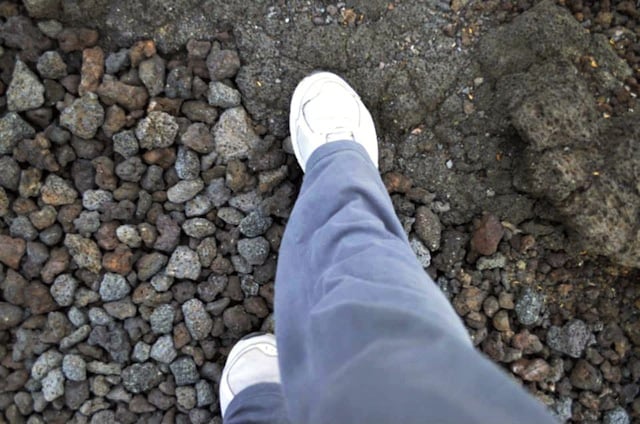
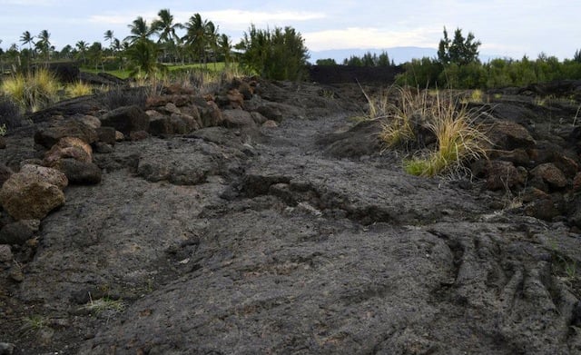
When you enter the Waikoloa Village (the complex where the Marriott is located) from Queen Ka’ahumanu Highway (Route 19), you’ll see a sign for the trailhead and free parking lot on your right. While at the very beginning the trek seems like it’ll be a paved road, the terrain becomes rough very quickly, although stays pretty flat throughout.
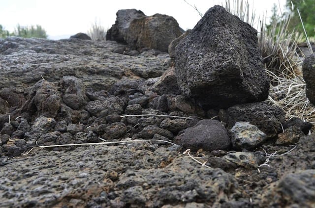
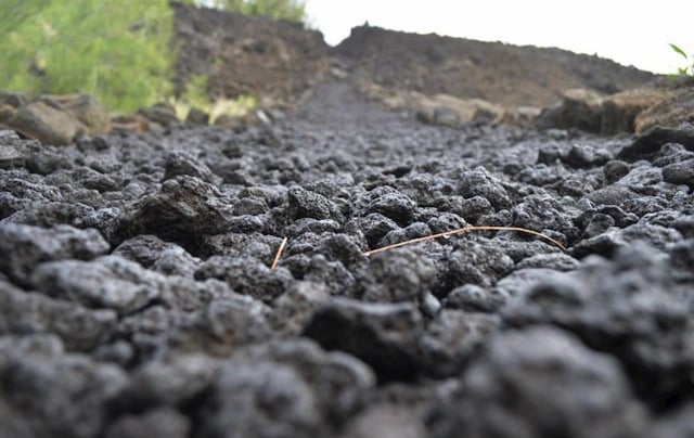
The entire time you’re immersed in volcanic rock, ancient terrain and petroglyph fields. Additionally, your surrounding views alternate between palm trees, golf courses, luxury properties and mountains, sometimes even a mix of both. The trail traverses around the entire island, although some sections are completely eroded; however, you’ll often be able to hike for 20+ miles (32+ kilometers) without stopping.
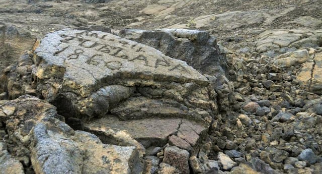
Not only is the King’s Trail scenic, it’s part of the Kaloko-Honokohau National Historical Park. Built between 1836 and 1855, by prisoners and local laborers for horse travel, it once went for 32 miles (51 kilometers), connecting the villages of Kailua and Kona in the south, and Puako to the north. Notice the rock shelves on both sides. These were used to keep the animals on the trail, even if the rider fell asleep.
The name of the trek — The Mamalahoa Trail — is also interesting, as the word “Mamalahoa” refers to a law passed by Kamehameha the Great to ensure the safety of travelers. Additionally, it pertained to an elite regime that acted under his rule to help conquer the surrounding islands and unite what we now know as Hawaii.
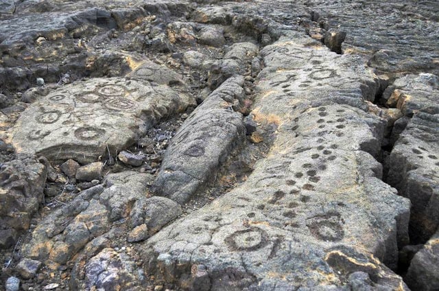
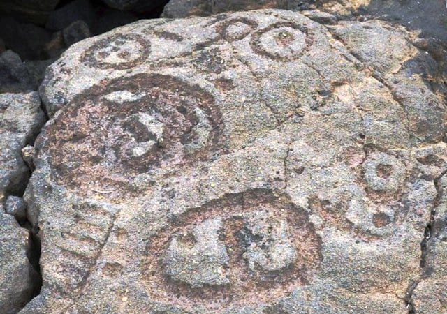
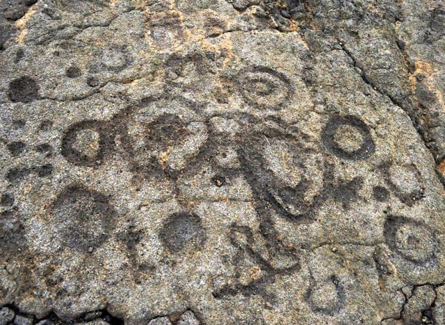
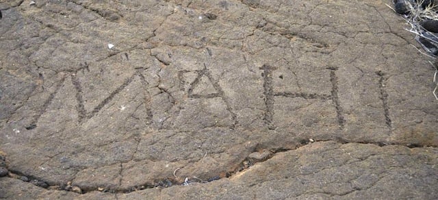
Petroglyphs are the main reason people hike the King’s Trail, as it’s home to one of the largest concentrations of ancient rock carvings in Hawaii. There are literally thousands — dating between 1400 and 1800 AD — with various religious and celebratory meanings, especially as crossing borders in these times was not something to take lightly. Petroglyphs were made using sharp stone tools crafted into a kind of chisel and hammer. Sharp rock fragment was used to dig the carvings further. Another method of creating petroglyphs included rubbing blunt stone against lava.
While it can’t be determined exactly what the carvings mean, it’s clear these were more than mindless drawings, as in ancient Polynesia no form of expression was done without meaning. That being said, there are some theories, for example, pictures representing guardian spirits, and concentrations of dots, lines and circle representing groups, days of travel or the number of trips made past a certain point. No matter they mean, it’s interesting to get a close-up glimpse into this ancient culture.
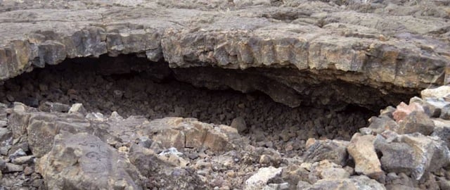
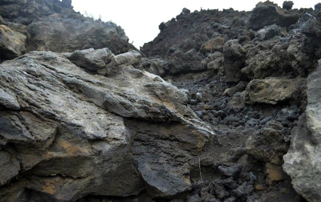
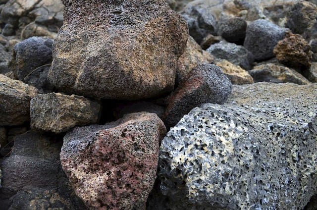
Cave shelter along the King’s Trail
You’ll also find an interesting cave shelter toward the beginning of the trail. These were used to hide armies defending or attacking a certain border. They were also encampments for shielding oneself from wind and bad weather.
To give you a better idea of what you’ll see on the trail, continue reading the photo essay below.

Jessica Festa is the editor of the travel sites Jessie on a Journey (http://jessieonajourney.com) and Epicure & Culture (http://epicureandculture.com). Along with blogging at We Blog The World, her byline has appeared in publications like Huffington Post, Gadling, Fodor’s, Travel + Escape, Matador, Viator, The Culture-Ist and many others. After getting her BA/MA in Communication from the State University of New York at Albany, she realized she wasn’t really to stop backpacking and made travel her full time job. Some of her most memorable experiences include studying abroad in Sydney, teaching English in Thailand, doing orphanage work in Ghana, hiking her way through South America and traveling solo through Europe. She has a passion for backpacking, adventure, hiking, wine and getting off the beaten path.